


Current projects
Project I
Groundwater mapping in High Plain Aquifer with NASA GRACE/FO and field observation
This research project utilizes NASA’s GRACE and GRACE Follow-On (GRACE-FO) satellite data to identify groundwater recharge and discharge zones and to better understand the patterns and drivers of groundwater depletion in Kansas and other agriculturally intensive regions. By integrating satellite-based terrestrial water storage changes with field-based observations and numerical modeling, we aim to map areas of significant water gain or loss, helping pinpoint zones most at risk. A key focus is on the challenges of applying GRACE data in aquifer systems with thick vadose zones, where the signal from groundwater is often masked by unsaturated soil moisture variability. Through this work, we will evaluate the uncertainties and limitations of GRACE in such settings and develop improved methods for interpreting the data. The ultimate goal is to support sustainable groundwater management strategies that are informed by both remote sensing and local field conditions, providing decision-support tools for farmers and water resource managers.
Funding: Kansas NASA EPSCoR Program, PI: Panthi
Project II
This project focuses on developing a coupled groundwater flow and contaminant transport model to address groundwater depletion and contamination in the Ogallala Aquifer, particularly in western Kansas. With over 90% of the aquifer’s water used for irrigation, this initiative aims to simulate nitrate and uranium transport in saturated layers, providing insights into sustainable water management strategies. The goal of this multidisciplinary project is to support agricultural sustainability and optimize water use within the food-energy-water nexus, ensuring the long-term viability of water resources in regions facing significant groundwater depletion.
Funding: Kansas Water Institute (2024 CoSearch First Place Award), 2025-2026, PI: Panthi (multidisciplinary award)
Project III
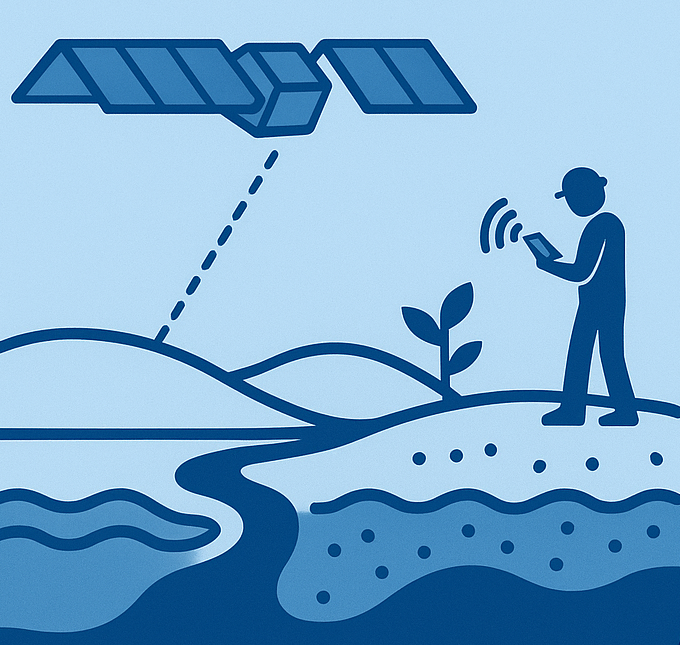
We are developing an operational model to estimate near-real-time chlorophyll concentrations, a key indicator of Harmful Algal Blooms (HABs), in Kansas water bodies. This model utilizes freely accessible satellite remote sensing data from Sentinel-2 and machine learning techniques. The goal is to address the limitations of existing models and improve the detection and monitoring of HABs in the nutrient-rich, turbid waters typical of Kansas. This project aims to provide critical data for state agencies and water managers to enhance their understanding and response to HABs, ultimately protecting aquatic ecosystems, public health, and economic stability.
Funding: USGS 104(b) Kansas (2024-26), PI: Panthi
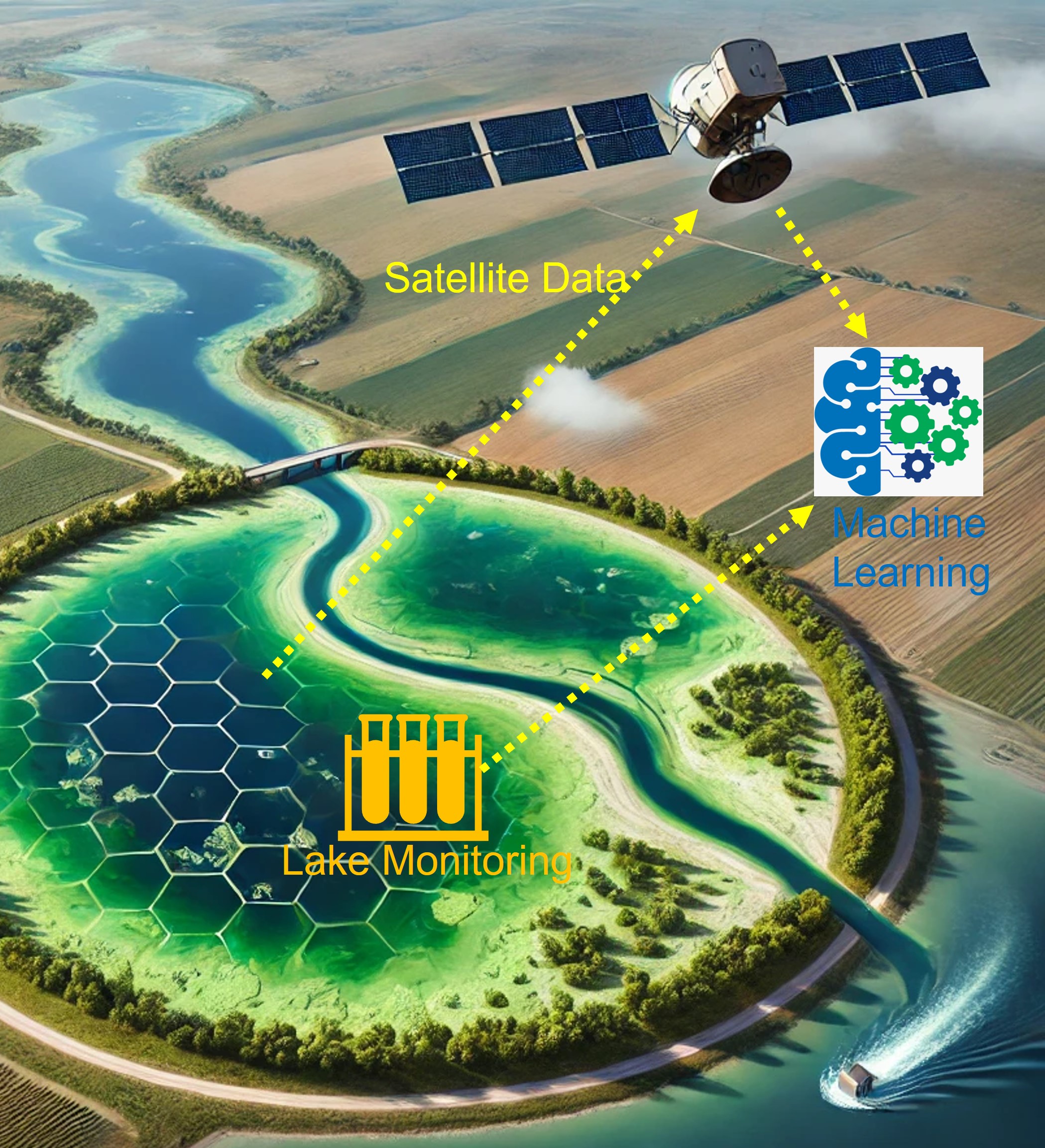

Chlorophyll index variation between winter and summer in Marion Reservoir, Kansas. Data source – Sentinel 2
Project IV
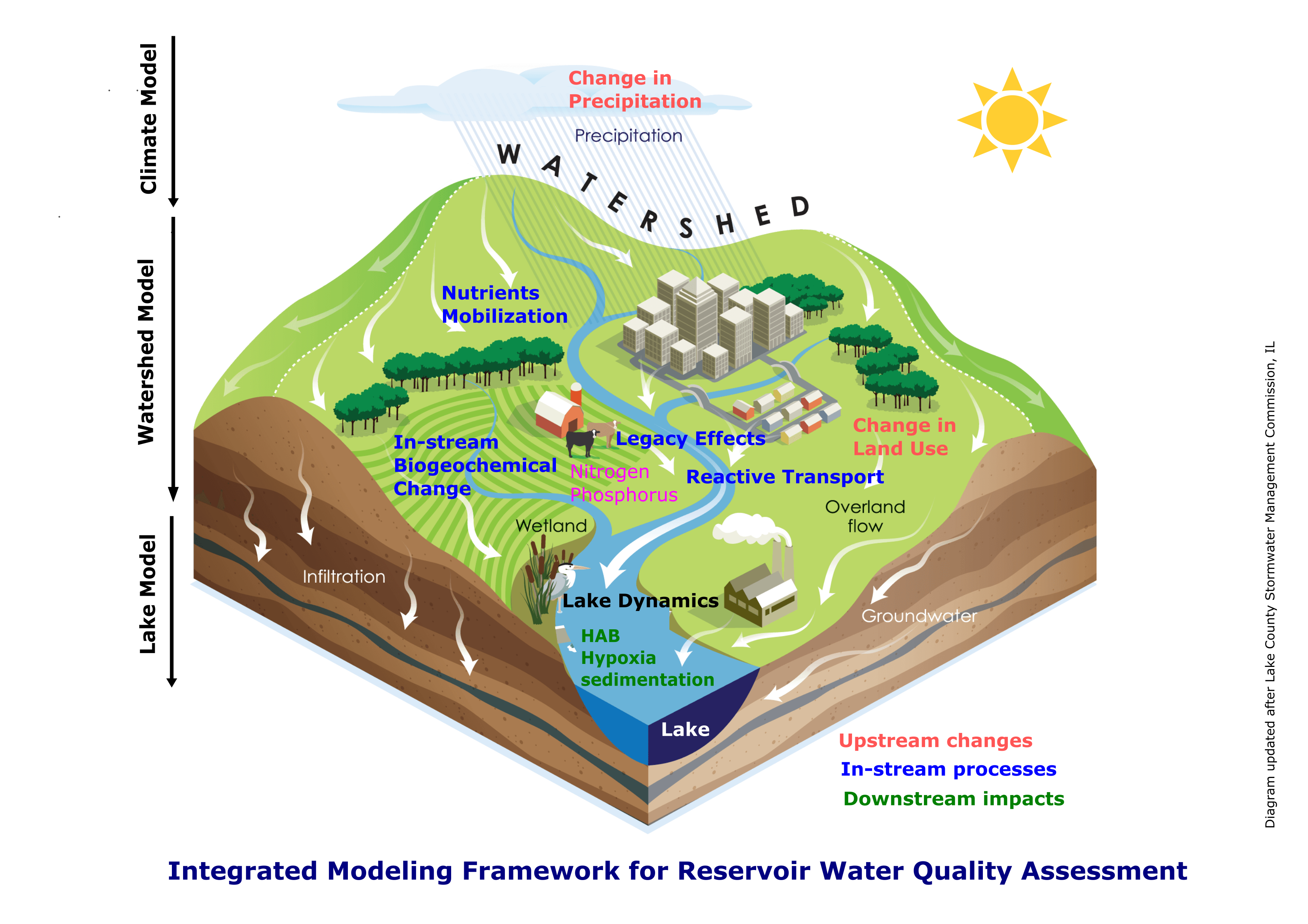
We are developing an integrated watershed hydrology and lake hydrodynamics model, with the primary aim of simulating the intricate processes involved in nutrient (Nitrogen and Phosphorus) transportation. Specifically, we are investigating how these terrestrial nutrients make their way to reservoirs situated in the Midwest region. A notable challenge in this endeavor is the absence of a comprehensive framework in existing water quality models to address the legacy effects of the nutrients. To bridge this gap, we are in the process of modifying a watershed modeling code. Our goal is to equip it with the capability to accurately capture the legacy effects of nutrients on water quality. By making these modifications, we aim to gain insights into how various land-management strategies and potential climate shifts influence water quality outcomes.
Past projects
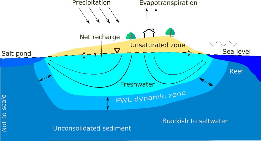
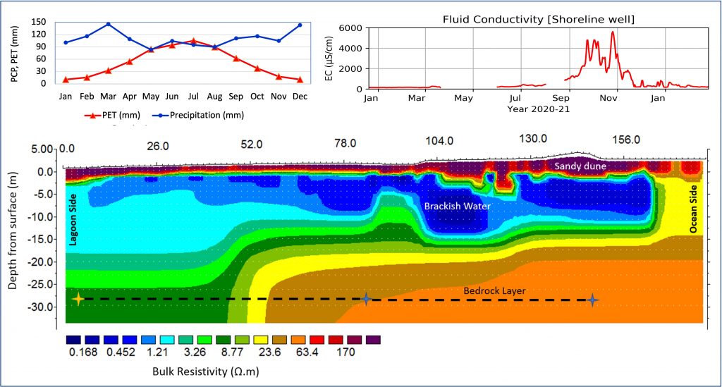
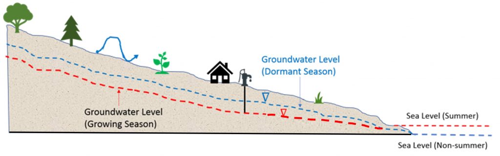
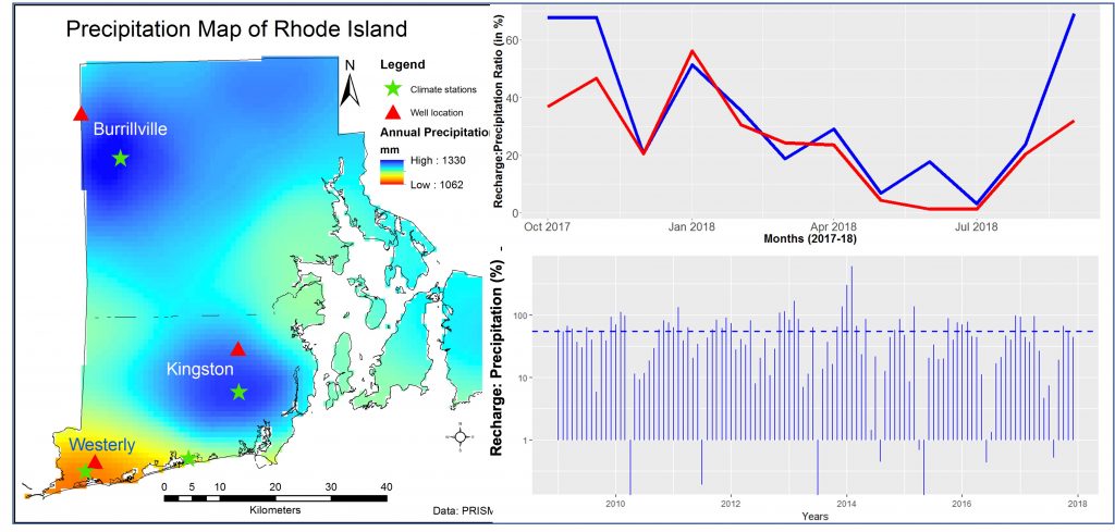
Dr. Panthi’s doctoral research delved into the understanding of the drivers of groundwater salinization and their interplay in unconfined coastal aquifers. He investigated the impact of ‘diffused events’ such as sea level rise and droughts on saltwater intrusion in barrier island aquifers. By developing a groundwater flow and solute transport model and analyzing monitoring well data and electrical resistivity imaging on the southern coast of Rhode Island, he showed that saltwater intrusion varies seasonally as a function of change in terrestrial groundwater head. Moreover, he projected the aquifer salinization and recovery time in variable recharge scenarios. The results illustrate the vulnerability of freshwater lenses to droughts and sea level rise in barrier islands. Calibrating numerical models using time-lapse geophysical data was my novel contribution to hydrological science. Developing a methodological framework to integrate resistivity imaging and a passive seismic technique, in collaboration with US Geological Survey, he showed that depth estimation of an unconsolidated coastal aquifer is more accurate when both methods are used in concert compared to the individual methods alone. Further, he devised and validated a mixing model to calculate the flux of fresh groundwater discharge utilizing time-lapse geophysical data. Read related papers here:
Barrier Island hydrodynamics modeling
Coastal groundwater monitoring
Here is an AI generated podcast about my coastal hydrology research, tune and enjoy listening to it.
Jeeban Panthi’s Podcast on Coastal Hydrology