


A. Field Hydrology
Electrical Resistivity Imaging
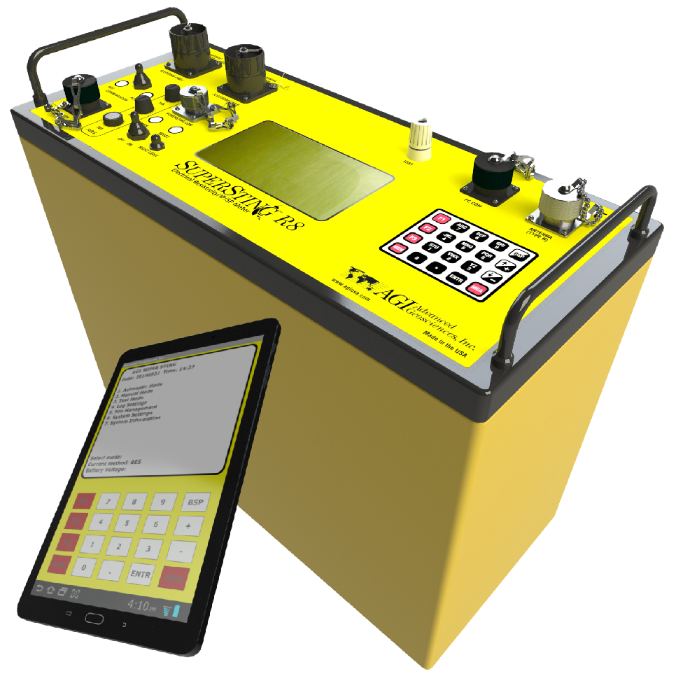
We use the AGI SuperSting R8 56-electrodes Electrical Resistivity Imaging system to visualize subsurface conditions and groundwater flow patterns. ERI offers a rapid, non-invasive approach for mapping aquifers, recharge zones, and hydrogeologic heterogeneity.
In collaboration with regional partners, our group integrate ERI with Nuclear Magnetic Resonance (NMR) to better understand hydrostratigraphy in the US High Plains aquifers.
This equipment is suitable for seawater intrusion mapping in coastal aquifers.
Water Level Monitoring
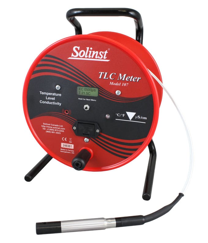
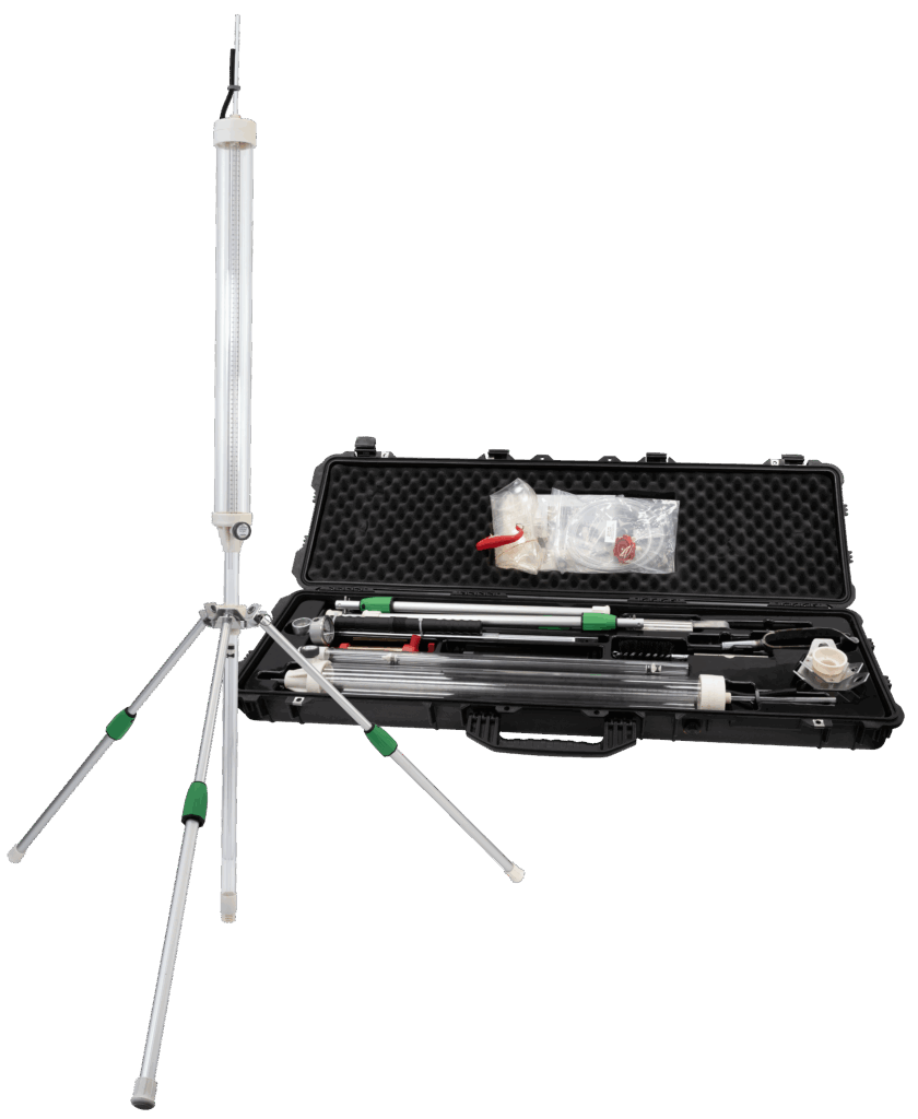
Solinst TLC Tape (Temperature, level and conductivity) – 30 m and 150 m.
We use Temperature, Level and Conductivity meter to measure well depth and water conductivity and temperature depth wise.
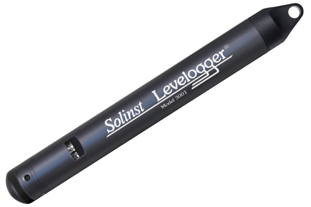
Solinst TLC Levelogger
TLC, Level and Barologgers
These loggers measure water level (pressure), temperature and conductivity at user-prescribed temporal frequency in well water. We use them to understand how aquifer response to seasonal and episodic recharge events and pumping.
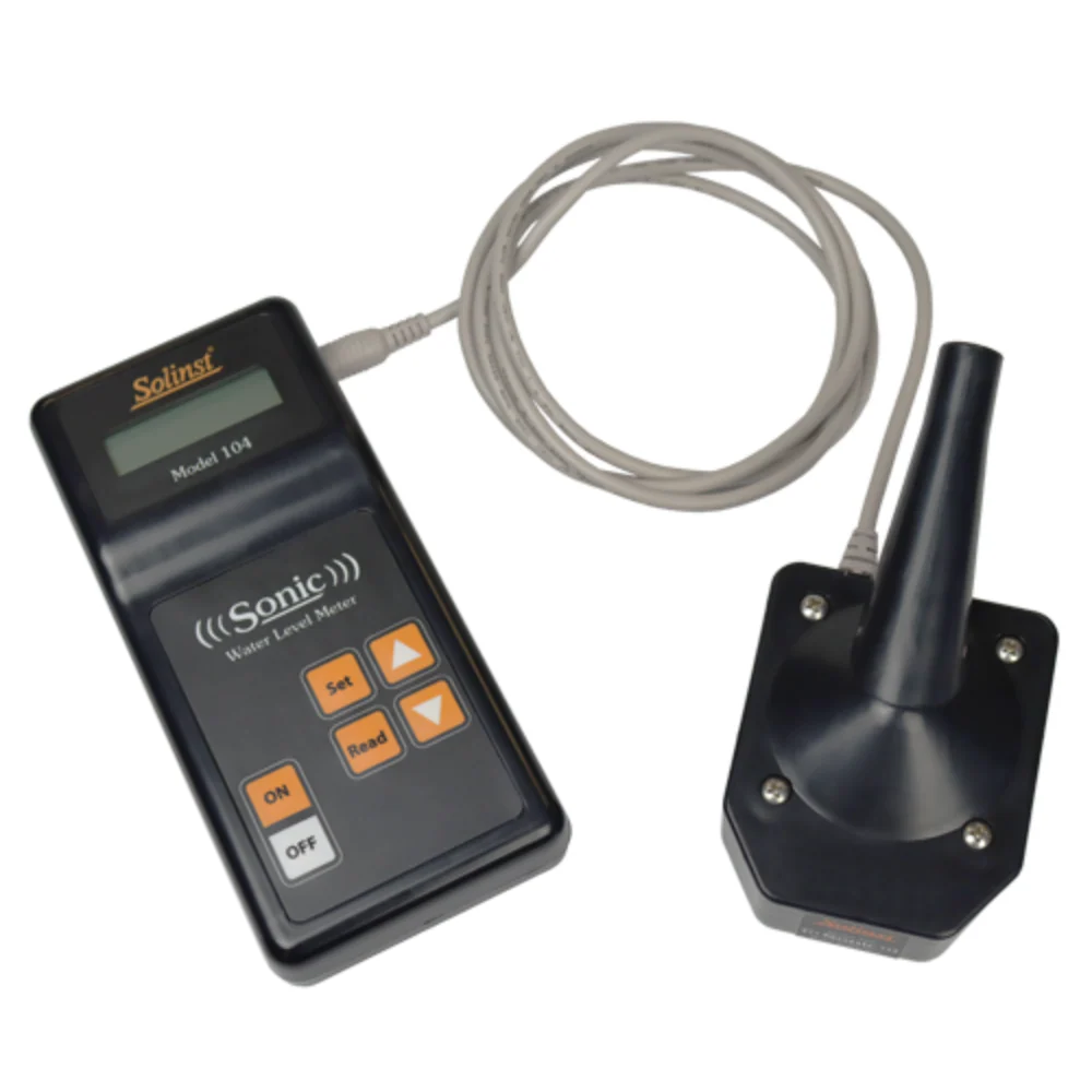
Sonic Water Level Meter
Sonic water-level monitoring systems use acoustic waves to accurately determine groundwater depth without direct contact with the water column. The technology enables efficient monitoring of groundwater fluctuations, recharge processes, and aquifer responses to stresses.
B. Aquifer Testing
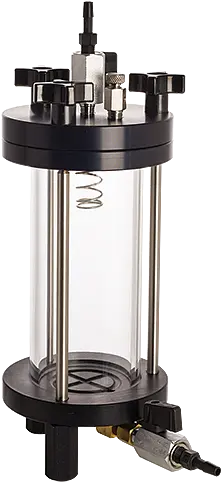
Guelph Permeameter Kit
Guelph Permeameter quantifies soil hydraulic properties by measuring steady-state infiltration under controlled hydraulic heads. These data are used to evaluate groundwater recharge potential, preferential flow pathways, and watershed hydrologic responses.
Humboldt Constant/Falling-head Permeameter Testing
This permeameter allows us to directly measure hydraulic conductivity in laboratory and observe Darcy’s Law in action. This system provides hands-on experience with fundamental hydrogeologic concepts such as hydraulic gradient, infiltration, and groundwater flow through porous media (soil).
C. Water Quality Monitoring
Water Quality Lab (KWI): The Kansas Water Institute has recently established a Water Quality Laboratory to provide technology, expertise, services, and training in advanced analytical science. This state-of-the-art facility produces high-quality testing with the aid of sophisticated instrumentation and well-trained scientists to be the critical nexus of water quality testing for the region. Our group use existing resources largely for water quality testing.
We have some field testing equipments listed below:
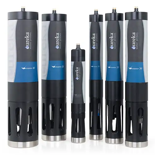
Solinst Eureka Multiparameter Sonde
The Solinst Eureka Manta+30A Multiprobe Sonde provides high-resolution, in situ measurements of water-quality parameters including temperature, pH, oxidation-reduction potential (ORP), conductivity, dissolved oxygen, turbidity, nitrate, and water depth. These observations are important in understanding groundwater quality, nutrient transport, lake and reservoir dynamics, and groundwater–surface water interactions.
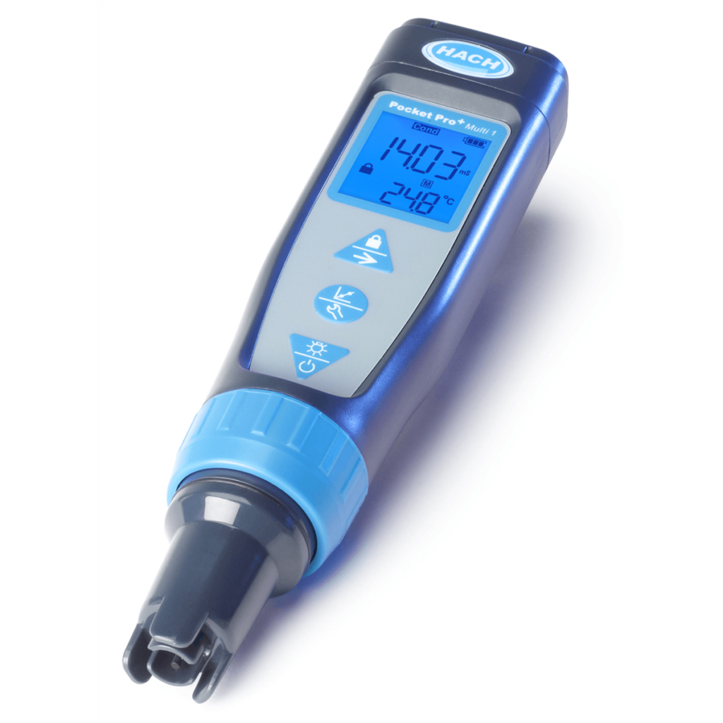
Hach Hand-held Multiparameter Instrument (pH, Conductivity/Salinity)
This hand-held piece is useful for rapid testing of pH and electrical conductivity in the field. It uses lithium battery.
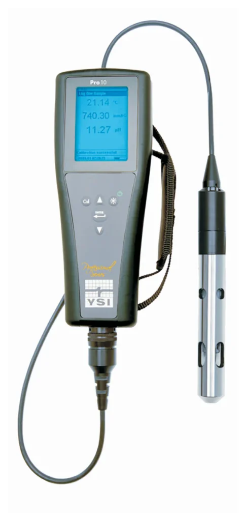
Hand-held YSI PRO 10 Pro
This hand-held piece is useful for field testing of pH and electrical conductivity in the field. It uses rechargeable lithium battery.
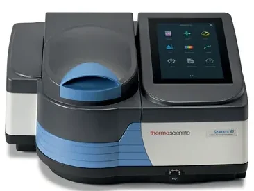
UV-VIS GENESIS Spectrophotometer
The UV-VIS GENESYS Spectrophotometer is used to quantify the concentration of chemical constituents in water by measuring light absorption across ultraviolet and visible wavelengths.
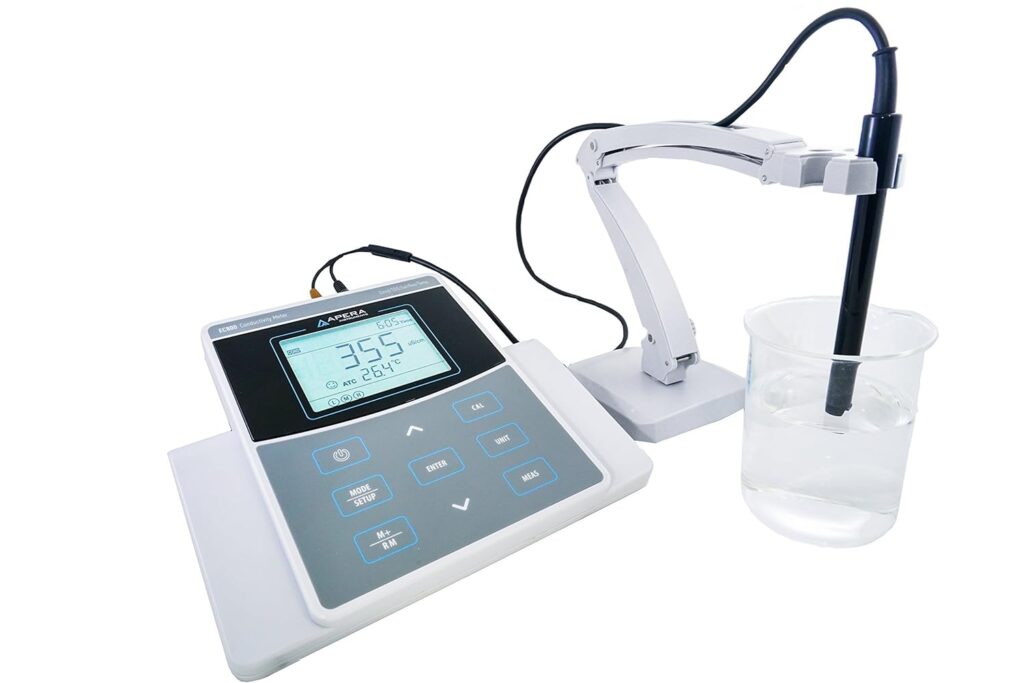
Bench-top pH & and Conductivity Meter
Dual probe meter to measure pH and Conductivity (temperature corrected).
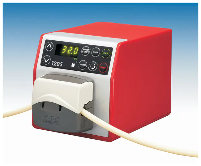
Watson-Marlow 120 Series Peristaltic Pump
THis peristaltic pump moves liquids through flexible tubing using a rotating roller mechanism and by eliminating direct contact between the pump components and the fluid. The pump provides accurate, contamination-free flow control and we use it for groundwater and surface-water sampling, filtration experiments, column studies. Its adjustable flow rates and gentle pumping action make it particularly suitable for handling water samples without altering their chemical characteristics.
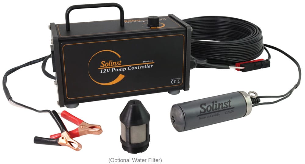
Submergible Water Pump
We use submergible water pumps for groundwater sampling, aquifer testing, and monitoring well development. These pumps enable the collection of representative groundwater samples and support investigations of groundwater flow, recharge, and water-quality dynamics.
D. Computational Resources
K-State Beocat
Beocat is Kansas State University’s high-performance computing (HPC) cluster that provides advanced computational resources for data-intensive research. We use Beocat to run large-scale hydrologic, hydrogeologic, geophysical, and machine-learning models that would be impractical on standard desktop computers.
K-State Geocat
We utilize K-State GeoCAT to analyze Earth observation datasets and geospatial information supporting research on groundwater resources, watershed processes, water quality, and environmental change. GeoCAT facilitates the integration of satellite remote sensing, climate data, GIS layers, and numerical models for multidisciplinary water research.
Software/Licenses
We have a bunch of softwares and licenses available for computation and data-model integration.
MODFLOW, Visual MODFLOW flex, ArcGIS, QGIS, QSWAT+, HEC-RAS, and many more.
Freely available data/resources for research and teaching
TADA Shiny [Download Water Quality Data]
Code/Programs
Jupyter Notebook (python coding)
Inkscape (free version of adobe illustrator)
Connedtedpapers.com (Explore connected papers in a visual graph)
Foldable Aquifer
(Make your own paper aquifer models)
Online Groundwater Model (Parflow)
Delineate a watershed (within USA), Streamstats
Forum/Conference/Meeting
American Geophysical Union (AGU)
Geological Society of America (GSA)
International Association of Hydrogeologists (IAH)